
The city that was drawn before it was built
Most American cities grow the way rivers do, finding their course by accident and habit, widening here, silting up there, and only much later deciding to look intentional. Coral Gables grew the other way around. Before there were streets, there was a drawing. Before there were residents, there was a style book. Before there was a downtown, there was a promise, printed in brochures and painted on billboards, that this place would be beautiful on purpose — and that it would stay that way, because the beauty was written into the rules of the place itself.
That is why walking Coral Gables feels different from walking anywhere else in greater Miami. A few miles southwest of downtown Miami, past the expressways and the glass towers, the city narrows into tree tunnels. Banyan roots grip the sidewalks. Coral rock walls, rough and golden, edge front gardens. Roofs are barrel tile, the color of terracotta left in the sun. Arched loggias throw shade across stucco walls. Street names — Alhambra, Granada, Sevilla, Cordova, Majorca — read like an itinerary through Spain, and that is not a coincidence: it is the itinerary the city's founder had in mind. Coral Gables is not a neighborhood that happens to have nice houses. It is a work of urban design that happens to have become a city, and a century after its founding it remains the clearest surviving example in Florida of the City Beautiful idea — the early twentieth-century belief that a city could be made better, healthier, and more civic by being made beautiful, with planned boulevards, public squares, monumental gateways, and architecture held to a common standard.
The man behind it was George Edgar Merrick, a developer who was barely out of his teens when he began imagining the city, and not yet forty when it was incorporated in 1925. Merrick did not invent Mediterranean Revival architecture, and he did not invent the planned community. What he did, with an ambition that still seems startling, was to apply both at the scale of an entire city, and to do it fast — building the core of Coral Gables in a few feverish years at the height of the Florida land boom, and then watching the boom collapse beneath him almost as soon as the city was finished. The city survived its founder's fortune, survived the hurricane of 1926, survived the Depression, and kept its plan. That survival is the real story of Coral Gables: not just that a beautiful city was drawn, but that the drawing held.
A grove, a family, and a name
Coral Gables begins, like so many Florida stories, with a family arriving from somewhere colder and deciding to stay. Merrick's father, the Reverend Solomon Merrick, was a Congregational minister from Massachusetts who moved his family to South Florida in the late nineteenth century and bought land southwest of Miami. The Merricks first lived in a wooden cottage built in 1899 on a 160-acre plot, and then, in a house completed in 1910, in a home built of the local stone — oolitic limestone, the pale, porous rock quarried from the South Florida ground, full of tiny shells and coral fragments, that Floridians call coral rock. The family named the house "Coral Gables," after the stone it was built from and the gables of its roof, and called the surrounding groves the Coral Gables Plantation. The city that rose around it took the house's name, and the house — the Coral Gables Merrick House, at 907 Coral Way — still stands, preserved with its fourteen rooms and its wraparound porch, as the place where the city's story starts.
George Merrick grew up in those groves. He knew the land the way a farmer's son knows land: its high ground and its low ground, its rock ridge and its water table, the places where a road would drain and the places where it would flood. That knowledge mattered, because Coral Gables was not built on a blank map. It was built on a working plantation, and Merrick's plan kept the plantation's logic even as it replaced the groves with streets. The broad avenues follow the old grove lines. The residential streets curve where the land curves. And the coral rock that gave the family house its name became the city's signature building material, dug from its own ground, cut into blocks, and laid up as walls, gateposts, fountains, and garden ornaments across the new city. When Merrick's brochures boasted that Coral Gables was a city built of its own stone, it was literally true.
Merrick's mother, Althea Fink Merrick, shaped the architecture as surely as her son shaped the plan. Long before air conditioning, she adapted the family's New England house forms to the South Florida climate: deep overhangs, a porch that wrapped around the house, a barrel-tile roof, and decorative vents that let hot air escape. Those adaptations — shade, airflow, thick walls, outdoor rooms — became the grammar of Coral Gables houses: buildings designed to live in the heat rather than fight it, with loggias and courtyards and patios as real living space. It is a grammar the city still speaks. Step off Miracle Mile into a residential street in the Gables and you will see it everywhere: houses that turn their shaded sides to the street, walls of coral rock, tile roofs, and gardens that are treated as rooms, not leftovers.
Merrick's vision: a Mediterranean city in the tropics
Merrick's vision for Coral Gables is usually summarized in two words — "City Beautiful" — but the phrase needs unpacking, because Merrick meant something specific by it. The City Beautiful movement, fashionable in American planning in the first decades of the twentieth century, held that monumental public spaces, orderly boulevards, and harmonious architecture would produce not just prettier cities but better citizens: civic pride, public health, and social order would follow from beautiful surroundings. Merrick took that doctrine and gave it a Mediterranean accent. In a 1925 interview with The New York Times, he said he could hardly explain why he had chosen the Spanish type of architecture for Coral Gables, "except that it always seemed to me to be the only way houses should be built down there in those tropical surroundings." The climate was the argument: whitewashed and tinted stucco to throw back the sun, tile roofs, arcades, courtyards, fountains, and patios were not stage dressing but a building tradition evolved for hot places, from Andalusia to the Caribbean, and Merrick believed South Florida belonged in that tradition.
So the Coral Gables Corporation — Merrick's development company — did not merely subdivide lots and sell them. It designed the whole city at once: a street plan of boulevards and circles and plazas; a commercial district at its center; residential sections arranged around parks and waterways; grand entrances marking the city's gateways; and a set of architectural standards, enforced by the company, that required new buildings to conform to the Mediterranean Revival style. The company's staff reads like a roll call of the talent Merrick assembled: Phineas Paist as supervising architect, Denman Fink — Merrick's uncle, an artist — as art director, and collaborators including Walter De Garmo and Paul Chalfin. Fink painted murals, designed fountains, and set the decorative program; Paist drew the buildings; and Merrick, famously, walked the ground himself, directing where streets would go and which trees would stay. The result was a city with a house style in the strongest sense: not identical houses, but houses that rhyme — different sizes, different plans, but the same materials, the same roof tiles, the same palette of stucco tints, the same vocabulary of arches and ironwork and tile.
That house style was also a sales strategy, and Merrick was a brilliant salesman. Coral Gables was marketed across the country during the Florida land boom of the 1920s, when the state was gripped by a speculative fever unlike anything it had seen before — or, arguably, since. Merrick's brochures promised "America's finest suburb" and "The City Beautiful," and his sales operation was theatrical: prospective buyers were taken on bus tours of the new city, and the tour's first stop was deliberately the most spectacular thing Merrick had built — a swimming pool carved from a coral rock quarry and dressed up to look like Venice, which is to say, the Venetian Pool, which has its own article in this journal and is mentioned here only as the showpiece it was designed to be. The pitch worked. In three years, Merrick spent more than twenty million dollars building a thousand Mediterranean-style houses, along with hotels, country clubs, and community buildings. Coral Gables was incorporated as a city in 1925, at the very crest of the boom.
Boom, bust, and the hurricane
The timing was almost cruelly perfect. The Florida land boom collapsed in 1925 and 1926, as speculation outran reality and the flow of buyers dried up. Then, in September 1926, a devastating hurricane struck South Florida, killing hundreds and wrecking much of the region's new construction. Coral Gables, barely a year old as an incorporated city, was hit hard. Construction slowed drastically. The grand civic building at the west end of the new downtown — the Coral Gables City Hall — was built from 1927 through 1928, during one of South Florida's most difficult financial periods, and its slow, careful construction through the bust is itself a kind of statement: the city kept building its civic center even when the money had gone.
Merrick himself did not survive the bust as a developer. He lost the fortune he had made and, in time, the control of the city he had created. His later years were spent far from Coral Gables, and he died in 1942. It is one of the great ironies of American urban history that the man who drew the city lost it, while the drawing outlived him. The reason is that Merrick had built something more durable than a real-estate promotion: he had built a city government, a zoning code, and a civic identity that other people — residents, commissioners, preservationists — took up and defended after he was gone. In 1973, Coral Gables became one of the first cities in Florida to adopt a historic resources ordinance, creating a historic resources board and a procedure for local landmark designations. Today the city counts hundreds of locally designated properties, alongside its National Register listings. The plan survived because it was converted, in time, from one developer's vision into a community's law.
That legal afterlife is visible in the way Coral Gables still regulates itself. The city is famous — notorious, to some — for its strict zoning and aesthetic codes: rules about paint colors, roof materials, signage, landscaping, and the design of new buildings, all descended from the Coral Gables Corporation's original standards. Love them or chafe at them, they are the reason the city still looks like itself. In most American cities, a 1920s plan is a historical document. In Coral Gables, it is still, in large part, the law. Walk the residential streets and you are seeing not a preserved museum district but a living code at work: new houses still rhyme with old ones, additions still defer to the street, and the canopy still matters as much as the architecture.
Miracle Mile: the downtown Merrick planned
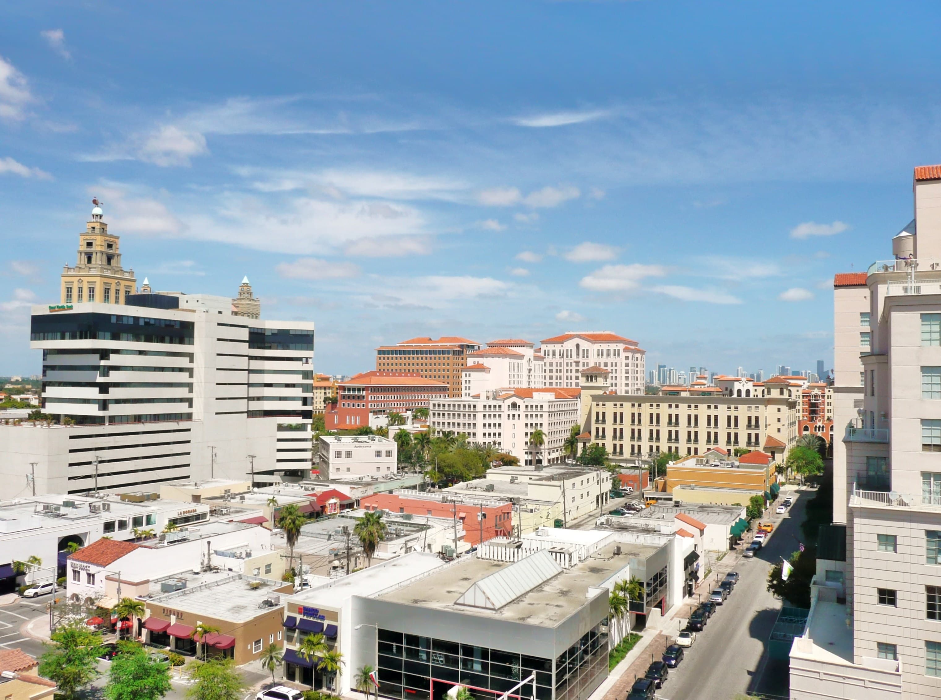
If the residential streets are Coral Gables' private poetry, Miracle Mile is its public room. The Mile is a half-mile section of Coral Way, running between Douglas Road in the east and LeJeune Road in the west, and it is the main east-west road through the city's downtown commercial district. Merrick designed the commercial district the way he designed everything else: as a complete composition, with the shops, offices, restaurants, and cultural buildings arranged along a single boulevard, so that, as he liked to boast, every business in Coral Gables was less than a two-block walk from the center. The LeJeune Road end of the Mile is anchored by City Hall, so that the city's civic building closes the view westward along the boulevard — a classic City Beautiful gesture, putting government at the end of the main street like a period at the end of a sentence.
The Mile was not always called Miracle Mile. The name came in 1955, after the district had declined during the Depression and the Second World War, when developers and business owners rebranded the boulevard as a high-end shopping destination. George K. Zain and his wife Rebyl Zain led that reinvention, and George Zain was later nicknamed the "Father of Miracle Mile." The rebranding worked, and the Mile has been Coral Gables' shopping and dining spine ever since: boutiques, galleries, restaurants, offices, and cultural venues, including the Miracle Theatre, home to the Actors' Playhouse, and the Colonnade Building at 133–169 Miracle Mile, designed in 1926 by Phineas Paist in collaboration with Walter De Garmo and Paul Chalfin in a mixture of Spanish Colonial and Baroque styles. The Colonnade is worth a pause: its arcaded facade, its ornament, its sheer confidence are pure 1920s Coral Gables, a commercial building designed with the same care as a civic one.
In the mid-2010s, Miracle Mile and the parallel Giralda Avenue underwent a major streetscape redesign, led by the New York firm Cooper Robertson, re-paving and replanting the two streets as a coordinated pair — Miracle Mile as the commercial boulevard, Giralda Avenue, one block south, as its pedestrian-oriented companion, closed to through traffic and lined with restaurant tables under the trees. The redesign's paving, in a palette of quartzites chosen to reflect the sky, was explicitly inspired by Merrick's own poetry about the city, and it is a good example of how Coral Gables renews itself: not by replacing the plan, but by reinterpreting it. Walk the Mile today and you are walking a 1920s boulevard with a 2010s surface, under trees that are older than both.
Giralda Avenue deserves its own mention, because it is where the Gables relaxes. Named for the Giralda tower of Seville — the same tower that inspired the Biltmore's famous tower — Giralda is the city's outdoor dining room, a place to sit under the canopy with a coffee and watch the city go by at walking pace. It is also a reminder of how thoroughly Merrick's Spanish itinerary saturates the city: even the street where you eat lunch is named for a bell tower in Andalusia. That is not kitsch, exactly, though it can feel like it at first. It is the logic of the plan carried to its conclusion: if you are going to build a Mediterranean city in Florida, you name its streets for Mediterranean places, you build its tower after a Mediterranean tower, and you let the whole thing rhyme.
The entrances: gateways to a planned city
No feature of Coral Gables expresses Merrick's ambition more clearly than its entrances. Merrick planned eight grand entrances to the city — monumental gateways, plazas, fountains, and towers that would announce, to anyone arriving by road, that they were entering a place unlike the unplanned sprawl around it. Only four were completed: the Douglas Entrance, the Granada Entrance, the Alhambra Entrance, and the Country Club Prado Entrance. Four is enough. They remain among the most distinctive structures in South Florida, and they are the first thing a thoughtful visitor should seek out after Miracle Mile, because they explain the city in miniature: architecture as welcome, as advertisement, and as civic art, all at once.
The Douglas Entrance, also known as La Puerta del Sol — the Gate of the Sun — stands at the junction of Douglas Road and Tamiami Trail (U.S. 41), at the city's northeastern gateway. Designed by Walter De Garmo, Phineas Paist, and Denman Fink, and completed in the mid-1920s, it is the most elaborate of the entrances: a great arched structure, angled forty-five degrees to the road, large enough to walk inside, with portions of its interior later used as offices. It was originally planned as part of a larger complex of shops, apartments, and townhouses; only the entrance itself was built. It was listed on the National Register of Historic Places in 1972, and it remains the city's ceremonial front door — the place where Coral Gables announces itself to traffic coming in from Miami.
The Granada Entrance, at the city's western approach along Granada Boulevard, is a pair of towers and walls in the Spanish style, framing the boulevard like a gate into a walled town. It is less grand than Douglas and more picturesque: a garden gateway, with coral rock walls and tile-capped towers, designed to slow you down and make you look. The Alhambra Entrance, at Douglas Road, Majorca Avenue, and Alhambra Circle, is its companion on the north side. And the Country Club Prado Entrance, along Coral Way, frames the boulevard's approach with a reflecting pool and formal plantings, the landscape architecture doing the work that stone does at Douglas and Granada.
Taken together, the entrances are Merrick's thesis in built form: a city should have thresholds. You should know when you have arrived. Modern Coral Gables has added later entrances in the same spirit — the Coral Way entrances at Red Road and at Douglas Road, completed in the 1990s, carry on the Mediterranean vocabulary with wall fountains, pools, and arched structures — but the four originals are the ones that matter historically, because they were built when the city was still an argument, not yet a fact, and they had to make the argument in stone.
The waterway and its Venetian bridges
If the entrances are Coral Gables' front doors, the Coral Gables Waterway is its back garden — and, for many visitors, its most surprising feature. Merrick dug a canal system through the city, connecting Biscayne Bay to the interior of the Gables, so that waterfront lots and a boating life could be threaded through a city that is, after all, several miles from the open bay. The waterway winds past houses, under bridges, and alongside the golf courses, and it gives Coral Gables something few planned cities have: a second circulation system, by water, as picturesque as its streets.
The waterway's bridges are the point. Merrick's planners gave the canal crossings the same treatment they gave the city entrances: small, arched, Mediterranean bridges, sometimes called the "Venetian" bridges, with coral rock parapets and tile details, designed to look like the bridges of Venice adapted to a Florida canal. They are not grand structures — they are garden structures, scaled to a residential canal — and that is their charm. From a canoe or a kayak, or from the bank at golden hour, they read as a sequence of small compositions: arch, water, reflection, banyan shade. The waterway also explains the placement of some of the city's most famous features: the Biltmore's golf course wraps around a canal that once carried guests by gondola toward the bay, and the whole southern portion of the city is organized around water as much as around roads.
There is a temptation, in writing about Coral Gables, to treat the waterway as a curiosity. It is better understood as evidence of how complete Merrick's plan was. A developer selling lots does not dig canals and build a dozen decorative bridges unless he is building a world, not a subdivision. The waterway is the world-building made literal: water, brought inland, so that the Mediterranean fantasy could include the boating life that the Mediterranean itself offers.
Two anchors, briefly: the Biltmore and the Venetian Pool
Two Coral Gables landmarks are so famous that they threaten to swallow the city that contains them, and both have their own full articles in this journal. They are mentioned here only briefly, as anchors of Merrick's plan, because no account of Coral Gables would be honest without them — and no account that repeated their full stories would leave room for the city itself.
The Biltmore Hotel, on Anastasia Avenue, was built in 1926 by Merrick in partnership with the hotelier John McEntee Bowman, designed by the New York firm Schultze and Weaver, and opened in January 1926 with a celebration that brought a thousand VIP guests to Coral Gables on special trains. Its tower, modeled on the Giralda of Seville Cathedral, rose 315 feet and was, on completion, the tallest building in Florida. It was the centerpiece of Merrick's resort vision: a luxury hotel, golf course, and country club that would give the new city a social center and a national reputation. Its later history — service as an Army hospital during the Second World War, years of vacancy, and restoration as a hotel — is told in its own article. What matters for this one is its place in the plan: the Biltmore was not an afterthought added to a successful city. It was a founding instrument of the city, built at the same time as the houses around it, to prove that Coral Gables was a destination, not just an address.
The Venetian Pool, on De Soto Boulevard, was the other founding instrument. Opened in 1924 as the Venetian Casino, in a former coral rock quarry, it was designed by Phineas Paist with Denman Fink and dressed in Mediterranean ornament — loggias, towers, a grotto, waterfalls, and Venetian mooring posts — so that a rock pit became a stage set for swimming. It was the first stop on Merrick's sales tours, and it remains the only swimming pool listed on the National Register of Historic Places. Its full story, too, belongs to its own article. Here it stands for Merrick's method: take something utilitarian — a quarry, a water tank, a canal bridge — and refuse to leave it utilitarian. Make it beautiful, and let the beauty do the selling.
City Hall and the Coral Gables Museum
At the west end of Miracle Mile stands the building that best represents what Coral Gables became after Merrick: a real city, governed from a real civic center, in architecture worthy of the plan. Coral Gables City Hall, at 405 Biltmore Way, was built from 1927 through 1928, designed by Phineas Paist and Harold Steward with Denman Fink as artistic advisor, in the Mediterranean Revival style, using the native oolitic limestone. It is three stories tall, with a stuccoed exterior, a tile roof, a central three-stage clock tower, and a Corinthian colonnade — a semicircular sweep of columns that faces the boulevard and gives the building its civic presence. Inside the tower, Fink painted a mural depicting the four seasons. The building was added to the National Register of Historic Places in 1974, and it has served as the seat of the city's government since it opened.
City Hall matters for a second reason: it was built through the bust. Where a lesser development would have left its civic center unbuilt when the money ran out, Coral Gables finished its city hall, slowly, through the hardest years of the late 1920s. That completion is a useful corrective to the idea that Coral Gables is only a real-estate fantasy. Fantasies do not finish their city halls during depressions. Cities do.
A short walk east from City Hall, on Aragon Avenue in the heart of downtown, stands the Coral Gables Museum, housed in the city's former police and fire station — a 1939 building in its own right — and devoted to the city's history, architecture, and urban design. The museum's galleries, plaza, and programs tell the story this article can only summarize: the planning, the architecture, the people, and the preservation battles that kept the plan alive. For a first-time visitor, it is the best single indoor stop in the Gables, because it explains the streets you have just walked. Check the museum's official listings before visiting for current exhibitions and hours; no hours are stated here, since none were verified against an official source in this run.
The University of Miami and the city's second founding
Coral Gables has had, in effect, two foundings: Merrick's city in 1925, and the university he helped bring to it in the same year. The University of Miami was established in 1925, with Merrick donating land and pledging a contribution to the new institution, and its campus — on land just south of downtown Coral Gables — has grown into one of the city's defining presences. The university's early years were as precarious as the city's: founded at the crest of the boom, it opened in the bust, and its first classes met in makeshift quarters. It survived, as the city survived, and grew into a major private research university, with a leafy, lake-dotted campus that feels like a Coral Gables neighborhood in its own right — Mediterranean buildings, arcades, courtyards, and a scale that defers to trees.
The university matters to a visitor for practical as well as historical reasons. Its campus is walkable, its public programs — lectures, concerts, exhibitions, and athletics — are part of the city's cultural calendar, and its presence explains something about Coral Gables that the architecture alone does not: this is not only a beautiful suburb but a college city, with students, faculty, researchers, and the institutions that cluster around a university, including the National Hurricane Center, which is headquartered in the area. The university also anchors the southern part of the city, balancing the downtown at the north end of Ponce de Leon Boulevard, so that the city's main axis runs from civic center to campus, with residential streets and parks in between.
The villages: seven small worlds inside one city
One of Merrick's most inventive ideas came after the core city was built, when he realized that some buyers did not want Mediterranean Revival at all. Rather than relax the style rules, he invented a loophole with charm: small themed villages within Coral Gables, each designed in a different international style, so that variety could exist without breaking the city's discipline. Seven themed villages were planned, including the Chinese Village, the French Normandy Village, the French Country Village, the French City Village, the Italian Village, the Dutch South African Village, and the Colonial Village. The Colonial Village, built between 1925 and 1926, is the most fully realized of the group, with houses designed in an American Colonial idiom by John Pierson and John and Coulton Skinner.
The villages are a delight to seek out, precisely because they are small and residential and not signposted like monuments. They reward the visitor who walks rather than drives: a turn off a main boulevard, a street where the roofs change pitch and the ornament changes language, and suddenly you are in a different country for a block or two, before the Mediterranean city resumes. They are also evidence of Merrick's flexibility as a planner. The man who insisted on a house style was willing to invent seven exceptions to it, because he understood that a city needs variety to feel alive, and that the way to allow variety without chaos is to contain it, theme it, and design it as carefully as everything else.
The canopy, the codes, and the question of beauty
Ask a Coral Gables resident what makes the city special and they will often answer before they mention architecture: the trees. Coral Gables is a city under a canopy. Its avenues are lined with banyans — the great strangler figs whose aerial roots descend like ropes and whose crowns spread wide enough to shade a whole street — along with live oaks, royal palms, and the flowering trees that give the residential streets their seasonal color. The canopy is not an accident. Merrick's plan planted it, the city's codes protect it, and its maintenance is a civic preoccupation. A roadside beautification program in 1929 planted more than a thousand banyan trees along Coral Way alone, and the city has been planting, pruning, and arguing about trees ever since.
The canopy does real work. It cools the streets by many degrees in summer, it softens the sound of traffic, it frames the architecture, and it gives the city its most beloved quality: shade. In a Florida city, shade is not decoration. It is infrastructure, as essential as drainage, and Coral Gables understood that a century ago. Walk Miracle Mile at noon in August and then walk a treeless commercial strip anywhere else in Miami-Dade, and you will understand the difference in your skin before you understand it in your mind. The Gables is walkable in summer because it is shaded in summer, and it is shaded because someone planted trees and someone else made a law to keep them.
That brings us to the question every honest account of Coral Gables must face: is a city that regulates beauty still a free place? The Gables' codes — on paint, on roofs, on signs, on fences, on trees — strike some visitors as admirable civic discipline and others as municipal fussiness. There is no neutral answer, and this article will not pretend to one. What can be said is that the codes are the reason the city looks the way it does, that they were chosen and repeatedly re-chosen by the city's own voters and commissions, and that they have preserved something genuinely rare: a whole city, not a district, whose 1920s plan is still legible in its streets. Many American cities have a historic district. Coral Gables is, in effect, a historic city, and that is a different and rarer thing. The price of it is regulation. The reward of it is the walk.
How to visit on foot
Coral Gables rewards walking more than almost any other city in South Florida, and the best way to see it is on foot, in a loop that follows Merrick's own geography. Start at City Hall, at the west end of Miracle Mile, and walk east along the Mile, pausing at the Colonnade Building and the Miracle Theatre, then turn south one block to Giralda Avenue for a coffee under the trees. From there, head south along Ponce de Leon Boulevard — the city's main north-south axis — toward the university district, or turn into the residential streets to see the houses, the coral rock walls, and the canopy at close range. The city's free trolley circulator runs primarily along Ponce de Leon Boulevard, with stops in the central retail district around Miracle Mile, and connects to the Douglas Road Metrorail station; check the city's current trolley information before relying on a particular stop or schedule, since routes and service details change, and no schedule is stated here as fact.
For a second, longer walk, drive or ride to the Granada Entrance and walk the boulevard inward, or seek out the Douglas Entrance at the city's northeastern edge and then follow the streets south into the residential quarters. The Alhambra Water Tower, at Alhambra Circle — a 1924 structure in which a utilitarian steel water tank was encased in a reinforced concrete and wood-frame shell designed to look like a lighthouse, with Moorish flourishes, by Denman Fink — is a short detour north of Coral Way and one of the city's most photographed curiosities: a lighthouse that has never seen the sea, built because Merrick refused to let even a water tower be ugly. It was used as a water tower until 1931, when Coral Gables began buying water from Miami, and citizen protests saved it from demolition in 1958. It stands today as the purest expression of the Merrick doctrine: no scar, no eyesore, no utilitarian object left un-designed.
Pair Coral Gables with the rest of Miami's historic core. Downtown Miami is a short drive northeast; Coconut Grove, Miami's oldest neighborhood, lies just east, across the bayfront; and the University of Miami campus, the Biltmore, and the Venetian Pool — each with its own story — are all within the city limits, close enough to combine into a single day. But do not rush the Gables itself. Its pleasures are slow ones: a shaded street, a coral rock wall, a fountain in a plaza, a tower glimpsed through banyans. Merrick designed a city to be walked, and a century later, walking is still how it gives up its secrets.
No fixed ticket price, fee, or opening hour is stated in this article, since none was verified against an official source in this run. The Coral Gables Museum, the Merrick House, the Biltmore, and the Venetian Pool each set their own hours and admission; check their official sources before visiting. The streets, the entrances, the waterway bridges, and the canopy are public and free to walk, at any hour when it is safe and pleasant to do so — which, under the banyans, is most hours of the year.
Location Photography


Key Facts
Coral Gables is a city in Miami-Dade County, Florida, southwest of downtown Miami, incorporated in 1925 and planned by developer George Edgar Merrick as a Mediterranean Revival "City Beautiful."
Merrick's family settled the land as a plantation; the family home, completed in 1910 and built of local oolitic limestone (coral rock), was named "Coral Gables," and the city took its name from the house.
The Coral Gables Corporation designed the whole city at once — boulevards, plazas, a downtown commercial district, residential sections, a waterway, and grand entrances — with Phineas Paist as supervising architect and Denman Fink as art director.
In three years at the height of the Florida land boom, Merrick spent more than twenty million dollars building a thousand Mediterranean-style houses plus hotels, country clubs, and community buildings; the boom collapsed in 1925–1926 and the hurricane of September 1926 struck the new city.
Merrick lost his fortune and control of the city; he died in 1942. The plan survived through city government, zoning, and preservation: in 1973 Coral Gables became one of the first Florida cities to adopt a historic resources ordinance.
Miracle Mile is a 0.503-mile section of Coral Way between Douglas Road and LeJeune Road, the main east-west road through downtown Coral Gables; its LeJeune Road end is anchored by City Hall. The commercial district was designed by Merrick; the name "Miracle Mile" dates to a 1955 rebranding led by George K. Zain and Rebyl Zain.
The Colonnade Building at 133–169 Miracle Mile was designed in 1926 by Phineas Paist with Walter De Garmo and Paul Chalfin in Spanish Colonial and Baroque styles. Giralda Avenue, one block south of Miracle Mile, is the pedestrian-oriented dining street; both streets were redesigned in the mid-2010s by Cooper Robertson.
Of eight planned grand entrances, four were completed: Douglas Entrance (La Puerta del Sol, at Douglas Road and Tamiami Trail, by De Garmo, Paist, and Fink, mid-1920s, National Register 1972), Granada Entrance, Alhambra Entrance, and Country Club Prado Entrance.
The Coral Gables Waterway is a canal system threading the city toward Biscayne Bay, crossed by small arched "Venetian" bridges with coral rock parapets; the Biltmore golf course wraps around a canal that once carried guests by gondola toward the bay.
The Biltmore Hotel (Anastasia Avenue, opened January 1926, Schultze and Weaver, tower modeled on Seville's Giralda, 315 feet, then Florida's tallest building) and the Venetian Pool (De Soto Boulevard, opened 1924 as the Venetian Casino in a former coral rock quarry, Paist and Fink, the only swimming pool on the National Register) are anchors of Merrick's plan; each has its own full article in this journal.
Coral Gables City Hall, 405 Biltmore Way, was built 1927–1928 by Phineas Paist and Harold Steward with Denman Fink as artistic advisor, in Mediterranean Revival style with native oolitic limestone, a three-stage clock tower, and a Corinthian colonnade; Fink's four-seasons mural decorates the tower interior. It was added to the National Register on July 24, 1974.
The Coral Gables Museum, on Aragon Avenue downtown, is housed in the city's former police and fire station and is devoted to the city's history, architecture, and urban design.
The University of Miami was established in 1925 with Merrick's donation of land and pledged contribution; its campus lies just south of downtown Coral Gables.
Seven themed villages were planned inside the city, including Chinese, French Normandy, French Country, French City, Italian, Dutch South African, and Colonial villages; the Colonial Village was built 1925–1926 by John Pierson and John and Coulton Skinner.
The Alhambra Water Tower (Alhambra Circle, 1924, Denman Fink) encases a steel water tank in a lighthouse-like shell with Moorish flourishes; used as a water tower until 1931 and saved from demolition by citizen protests in 1958.
The city's tree canopy — banyans, live oaks, royal palms — was planted under Merrick's plan (more than a thousand banyans along Coral Way in a 1929 beautification program) and is protected by the city's zoning and aesthetic codes, which still regulate paint, roofs, signage, landscaping, and new-building design.
The city's free trolley circulator runs primarily along Ponce de Leon Boulevard with stops in the Miracle Mile retail district and connects to the Douglas Road Metrorail station; check current city trolley information before visiting, as routes and schedules change.