

The oldest fortified ground in the harbor
Every harbor has a gate, and Boston's gate has always been Castle Island. The island — a 22-acre rise of land at the inner entrance to Boston Harbor, where the water narrows between South Boston and the open bay — has held a fortification since 1634, four years after the city itself was founded. No other spot in the harbor has been armed for so long, and no other spot in Boston lets you walk so easily from a 17th-century earthwork to a beach towel.
The story begins in July 1634, when the young town of Boston, worried about its defenses, looked out into the harbor and chose Castle Island for a fort. Twenty men, including Governor Thomas Dudley and his council, visited the island and agreed it was the perfect place for a fortress; each man present subscribed five pounds toward the work, and Deputy Governor Roger Ludlow and Captain John Mason of Dorchester were put in charge of building it. The first structure was modest — an earthwork with two platforms and, by 1635, three cannons, which the garrison fired at incoming ships until the vessel acknowledged the fort by raising its flag. Captain Nicholas Simpkins was its first commander. The fort was later known simply as "the Castle," and the island took its name from it.
It was not much to look at, but it was the beginning of something that would never stop. The site has been rebuilt eight times since, through every war and every change in military technology, from mud walls and pine logs to the great granite bastion that stands there now. Fort Independence is one of the oldest continuously fortified sites of English origin in the United States — and, remarkably, for all its centuries on guard, its guns were never fired in anger against an attacking fleet.
Castle William and the Revolution
The fort that most Bostonians of the 18th century knew was Castle William. Around 1692, the fortification was rebuilt in more substantial form and renamed for King William III, who ruled England with his wife Mary II. A further rebuilding between 1701 and 1703, under the military engineer Colonel Wolfgang William Romer, produced a brick, four-bastioned fort that dominated the harbor entrance for most of the century. By the time of the Boston Tea Party in 1773 it mounted more than 70 cannons, ranging from 9- to 42-pounders, and it was the strongest single fortification in the harbor.
Castle William was more than a fort; it was a refuge. When unrest swept Boston — after the Stamp Act crisis of 1765, after the Boston Massacre of 1770 — British officials and loyalists retreated behind its walls. The fort even held prisoners of note: after the Glorious Revolution of 1689, Governor Edmund Andros, a supporter of the deposed James II, was confined at the Castle and sent to England to stand trial. Stamps seized under the Stamp Act were stored there. And the island had a darker reputation as well: in its day it was known as the "Bladensburg of Boston," a dueling ground. Near the fort, a stone once marked the spot where Lieutenant Robert F. Massie, aged 21, fell in a duel on Christmas Day, 1817.
When the American Revolution came, Castle William became the British army's main stronghold during the Siege of Boston. From its walls the British could command the harbor, and after the battles of Lexington and Concord they fell back on it as their position in the town grew untenable. Then, in March 1776, George Washington's army fortified Dorchester Heights, just across the water, and placed cannon there that looked down on both the town and the fort. The British position became hopeless. On March 17, 1776 — Evacuation Day, still a holiday in Suffolk County — the British army sailed away, and as they left they set fire to Castle William to keep it from falling into colonial hands. A diarist recorded that by March 22 the old fort was burnt to ashes and destroyed.
The Americans rebuilt it at once. Troops under Lieutenant Colonel Paul Revere — the same Revere of the midnight ride, now an artillery officer — repaired the damage and put the fort back into service. First called Fort Adams, it was renamed Fort Independence on December 7, 1797, at a ceremony attended by President John Adams. (Some sources date the naming ceremony to 1799; the 1797 date is the one given in the standard histories of the site.) After the Revolution, the Commonwealth of Massachusetts used the fort as a state prison, from 1785 until the State Prison in Charlestown opened in 1805 — the first state prison in Massachusetts.
The eighth fort
The fort you see today is the eighth to stand on Castle Island, and it is a very different building from the brick Castle William. Beginning in 1801, the War Department built a new, five-bastioned brick fort on the site — the seventh fort — which helped protect Boston from British attack during the War of 1812. By 1811 the Secretary of War could describe it as "a regular pentagon, with bastions of masonry, mounting 42 heavy cannon, with two batteries for six guns."
Then came the great rebuilding. Between 1833 and 1851, under the direction of Colonel Sylvanus Thayer — the "Father of West Point" and one of the nation's leading military engineers — the fort was completely reconstructed in granite, doubling the former height, expanding its perimeter, and building casemate interiors. The result is the massive gray pentagon that crowns the island today: five bastions, thick granite walls, arched casemates inside, and a parade ground at its heart. It is a classic bastion fort of the age of masonry fortification, built just as that age was about to end — within a decade of its completion, rifled artillery would make such forts obsolete.
The fort's later military life was quieter but continuous. During the Civil War it served as a secondary seacoast defense, a recruiting and training camp, a prison for federal troops, and an ordnance-testing site. At the start of the war in 1861 it was garrisoned by the Fourth Battalion of Massachusetts Volunteer Militia, which organized the fort, drilled in infantry and artillery, and eventually formed the nucleus of the 24th Regiment, Massachusetts Volunteer Infantry. At least two other regiments — the 11th and 13th Massachusetts — also trained at Fort Independence, and Charles Francis Adams, the great-grandson of President John Adams, received his first military training there, calling it later "elementary in the extreme." At its peak strength during the war the fort mounted 96 cannon, some of them 15-inch Rodman guns capable of firing a 450-pound shot more than three miles.
The fort stayed in military hands through the Spanish-American War and both World Wars — the last military use was by the U.S. Navy during World War II — and in 1890 the federal government ceded Castle Island itself (though not yet the fort) to the Commonwealth of Massachusetts. In 1908 the fort, too, was handed over to Boston, and in 1962 the federal government permanently deeded both the island and Fort Independence to the Commonwealth. Fort Independence was added to the National Register of Historic Places in 1970, and today the whole 22-acre island is operated as a state park by the Massachusetts Department of Conservation and Recreation.
From island to peninsula
Here is the strangest thing about Castle Island: it is not an island anymore. For nearly three centuries it was a true island, reached only by boat, and that isolation was part of its military value. Then, in the late 19th century, Boston began to remake its shoreline. The landscape architect Frederick Law Olmsted — the designer of Central Park and Boston's Emerald Necklace — drafted a plan in 1883 for South Boston's Marine Park that envisioned connecting the park to Castle Island by filling in some 600 acres of mudflats, and naming the sheltered water in between Pleasure Bay.
The connection came in stages. A wooden footbridge was built in 1892, and for the first time the public could walk to the island — hundreds flocked there on weekends, and on Thursday nights in summer, dances were held under a wooden canopy hung with colored lanterns. The footbridge was replaced by a cement path across the newly made land in 1928, and then by a paved road in 1932. The island had become a peninsula, attached to South Boston by a narrow causeway, and it has been one ever since.
Pleasure Bay itself took shape alongside. An iron pier built in 1896 stretched seaward from the Head House and defined the bay; the 1938 hurricane heavily damaged it, and it was replaced in 1953 by a granite causeway. Six years later, in 1959, Pleasure Bay was enclosed by a dike with two openings that let the tide flow in and out — creating the calm, sheltered lagoon that is now one of the city's most popular swimming beaches. The land reclamation that joined the island to the mainland also pushed the mainland toward it: the ground between Castle Island and the city is now largely Massport's Conley Container Terminal, and the great ships that call there pass within sight of the old fort.
The Donald McKay monument
Walk around the island's north side, toward the main ship channel, and you come to a tall granite obelisk that most visitors pass without quite understanding what it is — and it is one of the most evocative monuments in Boston. It honors Donald McKay (1810–1880), the Nova Scotia-born master shipbuilder who opened his own yard on Border Street in East Boston in 1845 and built the fastest sailing ships the world had ever seen: the Flying Cloud, which sailed from New York to San Francisco in 89 days and 8 hours in 1851, and the Sovereign of the Seas, among more than thirty ships in all.
The monument was erected by public subscription in 1933, designed by William T. Aldrich, with a portrait medallion of McKay by Philip Sears. It is a four-sided shaft of light gray granite, and on the side facing north — toward East Boston, where McKay built his ships — is a profile of the builder and an inscription that reads: "Donald McKay, 1810–1880, Master-Builder whose genius produced ships of a beauty and speed before unknown which swept the Seven Seas. Made the American Clipper Ship famous the world over and brought renown and prosperity to the city of Boston." The panels list his ships, more than thirty of them. The monument stands deliberately in the path of the main ship channel, so that every vessel entering Boston Harbor passes it — the same channel McKay's clippers stood out through on their way to the open sea. There is a second memorial to McKay across the harbor, a pavilion at Piers Park in East Boston, so that he is commemorated on both sides of the water his ships sailed.
Walking the loop
The best way to see Castle Island is to walk it, and the island makes that easy: a paved loop of a little more than two miles runs around the whole peninsula, part of the Boston Harborwalk, and it is flat, open, and full of views in every direction. Start at the parking area by Sullivan's, walk past the fort, and keep going — the loop takes you along the causeway, past Pleasure Bay, around the point, and back along the harbor side, with the water on your left the whole way.
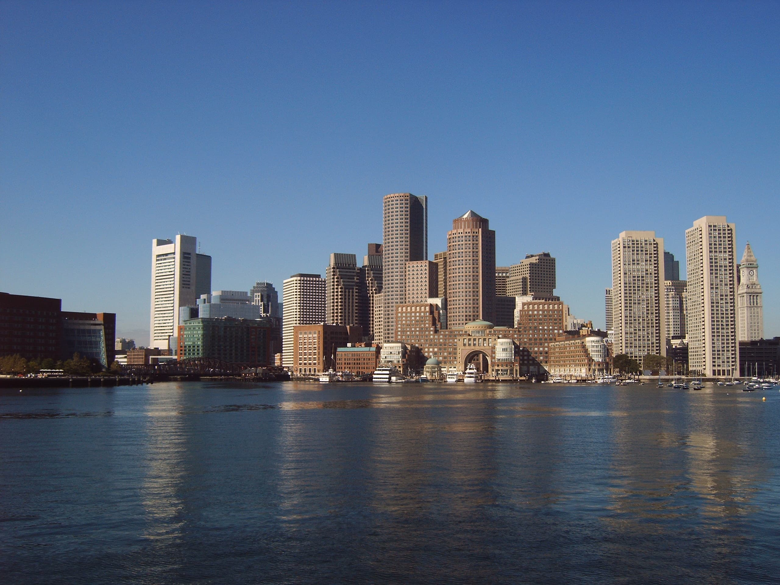
The views are the reason people come. Look north across the harbor and downtown Boston rises in full: the Custom House Tower, the Financial District, the Seaport's glass towers, all of it low and bright across the water. Look east and the Harbor Islands break the horizon — Georges Island, where Fort Warren stands, and the smaller islands beyond. Look up, often, because Castle Island sits directly under the flight path into Logan International Airport, and the planes come in low overhead, close enough to read the airline markings — children on the beach point at every one. The working harbor is always in motion too: container ships bound for Conley Terminal, tugs, ferries, sailboats tacking across the inner harbor, and the occasional tall ship. It is one of the few places in the city where you can watch Boston's maritime life the way the fort's garrison once did — as a panorama, from the water's edge.
The loop is popular with joggers and cyclists as well as walkers, and on a summer weekend it is crowded in the best sense: families with strollers, dogs on leashes, kite-flyers on the open ground near the fort, and anglers set up along the fishing pier just east of the fort. Fishing is a serious pastime here — striped bass and flounder are among the usual catch — and the pier is busy from early morning. The island's open lawns, the playground near the beach, and the breeze off the water make it one of the most democratic public spaces in the city: no ticket, no gate, just the harbor.
Pleasure Bay beach
On the south side of the causeway lies Pleasure Bay, the calm lagoon Olmsted imagined in 1883, and its sandy beach is the island's summer heart. The dike that encloses the bay keeps the water gentle, which makes it a favorite with families — children wade and splash in the shallows while parents sit on the sand with the downtown skyline in view. It is a city beach in the truest sense: you can get there by bus, spread a towel, and swim with the skyline behind you, a combination few American cities can offer.
The beach is part of a larger state park that includes Castle Island, Pleasure Bay, M Street Beach, and Carson Beach, all run by the Department of Conservation and Recreation, and the whole stretch of South Boston waterfront — from the island along Day Boulevard — functions as one long public shore. Come early on a summer morning and you will find swimmers doing laps in the bay, runners on the loop, and the island still quiet; come on a hot afternoon and the beach is full, the water is full of waders, and the line at Sullivan's stretches out the door.
Sullivan's
No account of Castle Island is complete without Sullivan's, the seasonal food stand beside the fort that has become as much a landmark as the fort itself. Dan Sullivan founded it as a hot dog stand in 1951, with the simple philosophy of "quality food at reasonable prices," and four generations of the Sullivan family have run it since. What began as a modest concession stand is now a South Boston institution: hot dogs, double smash burgers, thick crinkle-cut fries, lobster rolls, fried seafood, and soft-serve ice cream, eaten at picnic tables with the harbor in view. The stand was rebuilt in 1963 and again in the early 21st century, but it has kept its counter-service character and its place in the rituals of the neighborhood — generations of Bostonians count a summer as properly begun when Sullivan's opens, and properly ended when it closes for the season. In 2025 the James Beard Foundation honored Sullivan's with an America's Classics Award, given to restaurants with timeless appeal that are deeply rooted in their communities — a national recognition for a stand that has never pretended to be anything but a place to get a hot dog by the sea.
Sullivan's is seasonal, and its menu and hours change with the season, so check before visiting rather than relying on any fixed listing here. The same applies to the fort itself: tours of Fort Independence are conducted seasonally by volunteers of the Castle Island Association, in conjunction with the Department of Conservation and Recreation, and the schedule varies — check before visiting for current tour days and times.
How to visit
Castle Island is a public state park, open to the public year-round, and there is no admission charge to walk the island, the beach, or the loop. It sits at the end of William J. Day Boulevard in South Boston, and MBTA buses serve City Point, a short walk from the island — check the MBTA trip planner for current routes. Drivers will find a large parking lot beside the fort, which fills early on summer weekends, so come early or come by bus. Allow at least an hour for the loop walk, and a half day if you want the beach, the fort, and lunch at Sullivan's as well.
Inside the fort, the guided tours are the only way to see the casemates and the parade ground, and they are worth planning around — the Castle Island Association's volunteer guides know the eight forts, the guns, and the stories, and the view from the fort's ramparts, across the harbor to downtown, is the best in South Boston. Check before visiting for the current seasonal tour schedule. Come at golden hour if you can: the light goes low over the water, the skyline turns gold, and the old granite fort — which has watched this harbor since before there was a United States — looks exactly like what it is: the place where Boston began to defend itself, and never stopped.
Location Photography


Key Facts
- Castle Island is a 22-acre peninsula in South Boston on the shore of Boston Harbor; it was a true island until a concrete causeway connected it to the mainland in 1928. It has been the site of a fortification since 1634, and is one of the oldest continuously fortified sites of English origin in the United States.
- The first fortification was decided in July 1634, supervised by Deputy Governor Roger Ludlow and Captain John Mason of Dorchester; its first commander was Captain Nicholas Simpkins, and by 1635 it mounted three cannons.
- The fort became known as Castle William around 1692, named for King William III; rebuilt in brick between 1701 and 1703 by Colonel Wolfgang William Romer, it mounted more than 70 cannons by 1773 and served as a refuge for British officials during the Stamp Act crisis and after the Boston Massacre.
- The British made Castle William their main stronghold during the Siege of Boston and burned it as they evacuated on March 17, 1776; troops under Lieutenant Colonel Paul Revere rebuilt it. Renamed Fort Adams, it became Fort Independence on December 7, 1797, at a ceremony attended by President John Adams. (Some sources date the naming ceremony to 1799.)
- From 1785 to 1805 the fort served as Massachusetts' first state prison. Governor Edmund Andros was confined there in 1689 after the Glorious Revolution.
- The seventh fort, a five-bastioned brick structure, was built beginning in 1801 and helped protect Boston during the War of 1812; the Secretary of War's 1811 report described it as mounting 42 heavy cannon.
- The present granite fort, the eighth on the site, was built between 1833 and 1851 under Colonel Sylvanus Thayer. It is a five-bastioned pentagon with casemate interiors.
- During the Civil War, Fort Independence served as a secondary seacoast defense, a recruiting and training camp, a prison for federal troops, and an ordnance-testing site. The Fourth Battalion of Massachusetts Volunteer Militia garrisoned it in 1861 and formed the nucleus of the 24th Regiment, Massachusetts Volunteer Infantry; the 11th and 13th Massachusetts also trained there. At peak strength it mounted 96 cannon, including 15-inch Rodman guns firing a 450-pound shot more than three miles.
- The fort remained in military use through the Spanish-American War and both World Wars; the last military use was by the U.S. Navy during World War II. In 1962 the federal government permanently deeded Castle Island and Fort Independence to the Commonwealth of Massachusetts. The fort was added to the National Register of Historic Places in 1970.
- Frederick Law Olmsted's 1883 plan for Marine Park envisioned connecting the island to the mainland and creating Pleasure Bay; a wooden footbridge opened public access in 1892, a cement path replaced it in 1928, and a paved road in 1932. Pleasure Bay was enclosed by a dike with two tidal openings in 1959.
- The Donald McKay monument, a granite obelisk erected by public subscription in 1933 and designed by William T. Aldrich (portrait medallion by Philip Sears), lists more than thirty of McKay's ships and faces East Boston across the main ship channel.
- Sullivan's was founded as a hot dog stand in 1951 by Dan Sullivan and is now run by the fourth generation of the family; in 2025 it won a James Beard Foundation America's Classics Award.
- The island's walking loop is a little more than two miles, part of the Boston Harborwalk, with views of the downtown skyline, the Harbor Islands, and planes landing at Logan International Airport.
- Coordinates: 42.3369, -71.0049 (Fort Independence on Castle Island).
Visitor Details
Address: Castle Island, William J. Day Boulevard, South Boston, MA 02127 (at the end of Day Boulevard, beside Pleasure Bay).
Transit: MBTA buses serve City Point, a short walk from the island; check the MBTA trip planner for current routes. A large parking lot sits beside the fort and fills early on summer weekends.
Hours/Admission: Castle Island is a public state park, open year-round, with no admission charge for the island, beach, or walking loop. No fixed tour times, Sullivan's hours, or prices are stated in this article, since none was verified against an official source in this run. Fort Independence tours are seasonal and run by volunteers of the Castle Island Association — check before visiting for current tour days and times. Sullivan's is seasonal — check before visiting for current hours.
Best timing: Allow at least an hour for the loop walk and a half day for the beach, the fort tour, and Sullivan's. Come early on summer weekends for parking, and at golden hour for the light on the harbor.