
The harbor that made Boston
Boston is a city that was chosen by its harbor. When John Winthrop and the Massachusetts Bay Company settlers arrived in 1630, they first landed at Charlestown, across the water — and then moved, within weeks, to the Shawmut Peninsula, the three-hilled neck of land that is now downtown Boston. The reason was the water at its edge: a deep, sheltered natural harbor, guarded by a chain of islands and a narrow entrance, with fresh springs on the peninsula itself. It was one of the finest harbors on the Atlantic coast, and the settlers knew it the moment they saw it.
That harbor became the city's reason for existing. In the 17th and 18th centuries Boston grew rich on what moved across its wharves — fish, timber, rum, molasses, and the triangular trades that linked New England to the Caribbean and Europe. Wharves reached out into the water like fingers: Long Wharf, built between 1710 and 1721, once extended from the foot of State Street nearly a half-mile into the harbor, so that the largest ocean-going ships of the day could tie up in deep water and unload directly onto the wharf. At the time it was one of the great commercial structures in the colonies, and the streets that met it — State Street, then called King Street — were the commercial spine of the town. The Custom House, the counting houses, the warehouses, and the merchants' offices all clustered where the ships came in, because the harbor was the economy.
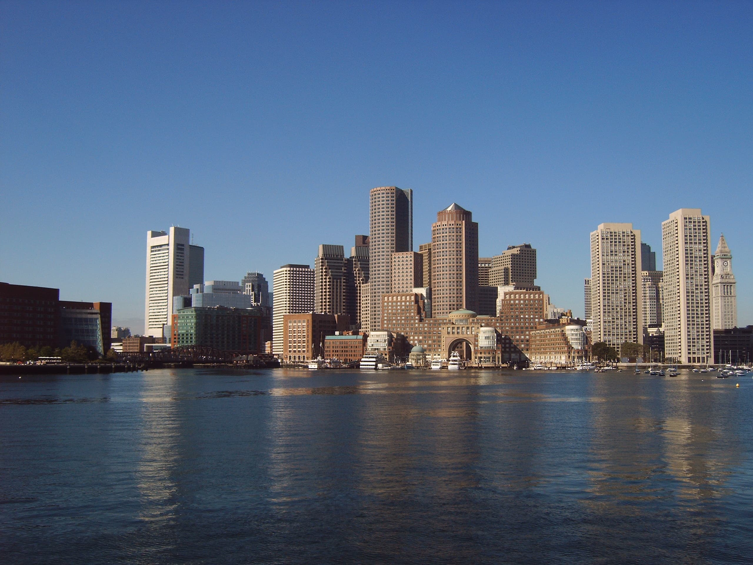
The harbor was also the city's first line of defense. Castle Island, at the harbor's inner entrance, has been fortified since 1634, and Boston Light — first lit in 1716 on Little Brewster Island — is the oldest lighthouse station in the United States still in operation. The islands that made the harbor safe also made it a maze: a captain who did not know the channels could run aground, which is exactly what the city's pilots and the lighthouse were for. The harbor's geography — a broad inner basin of roughly 50 square miles of water, broken by more than thirty islands — shaped everything about Boston, including its shape: the city you see today, stitched together by landfill, was once a small peninsula surrounded by tidal flats, and the harbor is the reason the landfill was needed at all.
The night the harbor became a teapot
On the night of December 16, 1773, Boston Harbor became the most famous body of water in America. Three ships — the Dartmouth, the Eleanor, and the Beaver — lay at Griffin's Wharf, loaded with tea from the British East India Company. Parliament's Tea Act of 1773 had given the company a monopoly on tea shipped to the colonies, and Bostonians saw it as taxation without representation and a threat to their own merchants. The ships had arrived in late November and early December, and under customs law the Dartmouth had twenty days to unload and pay the duty, after which officials could seize the cargo. Governor Thomas Hutchinson refused to let the ships leave without unloading.
That day, thousands of colonists packed into the Old South Meeting House to debate what to do. When the meeting broke up that evening, a group of men — somewhere between 60 and 150, many with their faces darkened and dressed to suggest Mohawk Indians — marched down Milk Street to Griffin's Wharf, boarded the three ships, and went to work. Over about three hours they hauled 342 chests of tea on deck, broke them open with axes, and dumped the contents into the harbor. They were disciplined about it: they destroyed only the tea, damaged nothing else, and even replaced a broken padlock on one of the ships. By one contemporary account, some 2,000 people watched from the wharf.
Parliament's response was swift and severe. The Coercive Acts of 1774 — the colonists called them the Intolerable Acts — included the Boston Port Act, which closed the harbor entirely until the East India Company was paid for the destroyed tea. The port that had made Boston was shut by law, and the closure helped push the colonies toward the war that began sixteen months later at Lexington and Concord. Today the Boston Tea Party Ships & Museum sits at Congress Street Bridge, near where Griffin's Wharf once stood, with a full-scale replica of the brig Beaver moored alongside — a reminder that the harbor's most famous night happened not on a battlefield but on the water, at a working wharf.
A working port and the age of the clippers
In the first half of the 19th century, Boston Harbor was the home port of the fastest commercial sailing ships the world had ever seen. The clipper ship — long, sharp-bowed, and built for speed above all else — was perfected here, and its greatest builder was Donald McKay, a Nova Scotia-born shipwright who opened his own yard on Border Street in East Boston in 1845. McKay's ships were built on the harbor's edge, launched into its waters, and sent out to race the world.
His first clipper, the Stag Hound, was launched in December 1850. A few months later came the ship that made his name: the Flying Cloud, launched on April 15, 1851, a 1,783-ton extreme clipper that sailed from New York to San Francisco in 89 days and 8 hours on her maiden voyage — a record for the passage that stood for decades. On that run she logged 374 miles in a single day, a speed that seemed almost unbelievable for a wooden sailing ship. McKay went on to build the Sovereign of the Seas in 1852 and, in 1853, the Great Republic, the largest wooden clipper ever built, at 4,555 tons. Boston's clippers carried gold-rush passengers to California, tea from China, and emigrants to Australia, and for a brief, glittering decade the city's name was synonymous with speed at sea.
The clipper age ended as quickly as it had come. The opening of the Suez Canal in 1869 favored steamships, which could keep a schedule no sailing ship could match, and the harbor's trade shifted toward steam, coal, and bulk cargo. But the clipper era left its mark on the city: the East Boston waterfront, the shipyards along the Mystic River, the captains' houses on the hills above the harbor, and a monument to McKay on Castle Island that lists his ships on its panels. The Flying Cloud still flies on the flag of East Boston, and the harbor's working character — the tugs, the tankers, the container traffic at Conley Terminal in South Boston — is the direct descendant of the port the clippers sailed from.
Decline, pollution, and the great cleanup
For much of the 20th century, the harbor paid the price of being a working port in an industrial city. Sewage from the Boston area flowed into the harbor with only minimal treatment, and by the 1970s and early 1980s the harbor was famously filthy — the butt of jokes, its beaches closed, its water unsafe for swimming, its mud laced with sludge. The two old treatment plants at Deer Island and Nut Island were antiquated and overwhelmed, and combined sewer overflows dumped raw sewage into the harbor and its tributaries every time it rained hard.
The turnaround began in court, not in the water. The Conservation Law Foundation sued in 1983, the Environmental Protection Agency took up the case in 1985, and Federal Judge A. David Mazzone ordered a full cleanup that year — a court-ordered mandate that created the Massachusetts Water Resources Authority (MWRA) and forced the region to rebuild its entire sewage system. The result was the Boston Harbor Project: a new, state-of-the-art treatment plant on Deer Island, a sludge-to-fertilizer facility in Quincy that ended the daily dumping of sludge into the harbor in 1991, and a 9.5-mile outfall tunnel that carries treated effluent out to the deep waters of Massachusetts Bay. The Deer Island plant began partial operations in 1995 and was fully operational in 2000, when the outfall tunnel was completed. The whole effort cost about $3.9 billion, and it worked: the harbor is now clean enough that its beaches regularly meet swimming standards, and the water that once smelled of sewage now supports harbor seals, striped bass, and a growing population of recreational boaters. It is one of the great environmental comebacks in American urban history, and it happened because a federal judge refused to let the city keep using its harbor as a sewer.
The Big Dig and the waterfront's return
The harbor's second great transformation came from above. For half a century, downtown Boston was cut off from its waterfront by the Central Artery, an elevated six-lane highway built in the 1950s that ran along the harbor's edge and walled the city off from the water. The Big Dig — the Central Artery/Tunnel Project — buried that highway in a tunnel beneath the city: planning began in 1982, construction ran from 1991 to 2006, and the project concluded in December 2007 at a cost of about $14.6 billion. When the elevated highway came down, the space it had occupied became the Rose Kennedy Greenway, a chain of parks that opened in 2008 and runs from Chinatown to the North End, stitching downtown back to the harbor it had been separated from for two generations.
The Greenway's opening changed the waterfront's center of gravity. The Wharf District — the blocks between the Greenway and the harbor, around Long Wharf, Central Wharf, and Rowes Wharf — became one of the most walkable stretches of the city, with the New England Aquarium at its heart. The Aquarium, designed by Peter Chermayeff of Cambridge Seven Associates, opened on Central Wharf on June 20, 1969, with its four-story Giant Ocean Tank following in 1970; it was one of the first institutions to bet on the downtown waterfront, arriving decades before the cleanup and the Big Dig made the bet pay off. Today the Aquarium, the Greenway, the Harborwalk, and the ferry terminals form a single continuous public waterfront — the thing the city had been trying to build since the Harborpark plan of 1984.
Walking the Harborwalk
The best way to understand Boston Harbor is to walk its edge. The Boston Harborwalk is a public walkway that follows the piers, wharves, beaches, and shoreline around the harbor — 43 miles of interconnected parks and paths, from Dorchester to East Boston, built up since the Harborpark initiative began in 1984. It is not one continuous trail; it is a chain of segments, some of them grand promenades, some of them narrow passages between buildings, all of them held open to the public by Massachusetts law, which has protected public access to the tidelands since colonial times.
The downtown stretch is the one most visitors walk, and it is the richest. Start at Long Wharf, where the ferries leave and the skyline rises behind you, and walk south past the Aquarium and Rowes Wharf, with its great arch, toward the Seaport — the former warehouse district that is now Boston's newest neighborhood, built on filled land at the harbor's edge. Or walk north from Long Wharf, through Christopher Columbus Park, along the North End waterfront past Battery Wharf and the Coast Guard station, toward Charlestown and the USS Constitution, launched in 1797 and still afloat at the Charlestown Navy Yard. Along the way the Harborwalk passes the sites of the city's history in the order the city made them: the wharves where the tea was dumped, the warehouses of the clipper trade, the piers where the ferries still run, and the parks where the highway used to stand. The interpretive signs along the route are worth reading — they are the harbor's own museum, outdoors and free.
The Harbor Islands
Look out from Long Wharf and the horizon is broken by islands — 34 of them, plus a few peninsulas, scattered across the harbor's 50 square miles of water. Since November 12, 1996, they have been protected as the Boston Harbor Islands National Recreation Area, a partnership of the National Park Service, the state, the city, and nonprofit groups that manages the islands as a single park. Twenty-one of the islands are also part of the Boston Harbor Islands Archeological District, and the islands carry more than four centuries of history between them: colonial farms, quarantine hospitals, military forts, a prison, a lighthouse, and a landfill that became a park.
Two islands get most of the visitors. Georges Island is home to Fort Warren, a massive granite Civil War-era fort that was built to guard the harbor's entrance and later used as a prison for Confederate officers; guided tours take you through its dark corridors and its parade ground, and the island is the hub for the shuttle boats that hop between the smaller islands. Spectacle Island, the closest island to downtown, was once a dump and a rendering plant, and is now a park with beaches, hiking trails, and a swimming beach — a reclamation nearly as dramatic as the harbor cleanup itself. Boston Light, on Little Brewster Island, has guided ships into the harbor since 1716 and is the oldest lighthouse station in the United States; it is open for occasional tours in the summer, reached by boat from the city. Ferries to Georges and Spectacle Islands run seasonally from Long Wharf, and the islands are the harbor's best argument for getting on the water: from their shores, downtown Boston looks the way it was meant to be seen — across the water, low and bright, with the harbor in the foreground.
Ferries, cruises, and getting on the water
Long Wharf is still what it was built to be: the place where you get on a boat. Ferries leave from its piers for the Harbor Islands, for Hingham and Hull on the South Shore, for Salem, and for Provincetown at the tip of Cape Cod. Commuter ferries cross the harbor to Charlestown and East Boston, and the MBTA's ferry routes — including the East Boston service that began in September 2022 — treat the harbor the way other cities treat a subway line: as the fastest way across town. Harbor cruises loop out past the islands and back, narrating the skyline and the history as they go, and whale-watching boats head out to Stellwagen Bank, the feeding ground off the coast where humpbacks gather in summer. Sunset cruises are the harbor's most reliable spectacle: the light goes gold over the water, the skyline turns to silhouette, and the city looks, briefly, like the port town it still is underneath everything.
Getting on the water changes the harbor completely. From the shore it is a view; from a boat it is a place, with currents, wind, and the working traffic of a real port — the tugs, the tankers, the container ships at Conley Terminal, the Coast Guard cutters, the sailboats tacking across the inner harbor on a summer evening. The harbor is still a working harbor, and that is part of its appeal: the same water that carries a whale-watching boat out to sea also carries the freight that keeps the region supplied, just as it has since 1630.
Long Wharf and the Aquarium
If the harbor has a front door, it is Long Wharf. The wharf today is much shorter than the half-mile pier built in 1710–1721 — landfill at the landward end has swallowed most of its length — but it is still the harbor's principal ferry terminus, and its end is one of the best places in the city to stand and look: back toward downtown, with the Custom House Tower rising over State Street, or out toward the islands and the open water beyond. The granite compass rose set into the wharf's paving, the old warehouse buildings that now hold restaurants and offices, and the Chart House at the wharf's end all belong to the harbor's working past, repurposed rather than replaced.
A few steps south, on Central Wharf, stands the New England Aquarium — the anchor of the modern waterfront, and the reason many visitors come to the harbor at all. Its Giant Ocean Tank, a four-story coral reef in the round, has been the building's centerpiece since 1970, and the Aquarium's harbor seals perform on the plaza outside, in full view of the water they came from. The Aquarium is also the harbor's scientific conscience: its researchers study the harbor's marine life, rescue stranded sea turtles, and run the programs that track the recovery of the water the cleanup made possible. Between the Aquarium and Long Wharf, the waterfront does what it has always done: it puts the city and the sea in the same frame.
How to visit
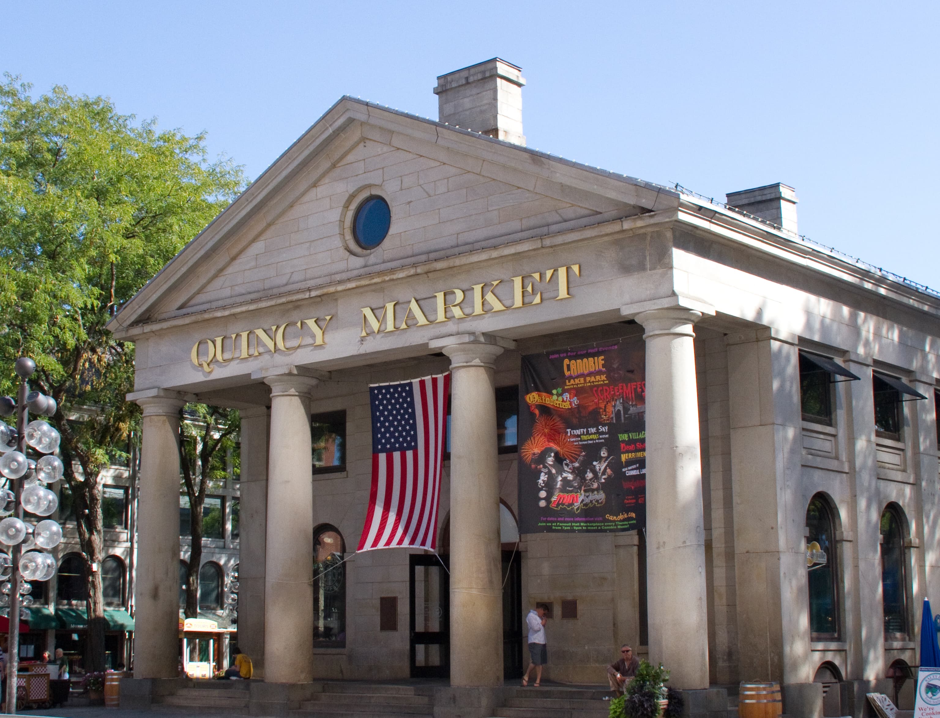
The harbor is not a single attraction with a gate — it is the city's front yard, and the best way to visit is to pick a stretch and walk it. Start at Long Wharf, at the foot of State Street in downtown Boston, reachable from the Aquarium T stop on the Blue Line or the State Street stop on the Orange Line, and from Faneuil Hall and Quincy Market a few minutes inland. From there the Harborwalk runs in both directions, and the ferries leave from the wharf itself. Allow a half day if you want to walk the downtown waterfront properly, and a full day if you are adding a Harbor Islands ferry — Georges and Spectacle Islands are the usual first choice, and the ferry ride itself is half the experience.
No fixed ferry fare, cruise price, or attraction admission is stated in this article, since none was verified against an official source in this run: fares and schedules vary by operator, route, and season, and island ferries run seasonally, so check the operator's site before visiting for current prices, timetables, and any booking requirements. The same applies to the Aquarium and the Tea Party Ships & Museum. Come at golden hour if you can — the light on the water is the harbor's best show, and it is free — and dress for wind: the breeze off the water is the one thing about the harbor that has never changed.
Key Facts
- Boston Harbor is a deep natural harbor of about 50 square miles of water, guarded by more than 30 islands; the Puritans chose the Shawmut Peninsula for it in 1630, and it has been the city's economic reason for existing ever since.
- Long Wharf was built between 1710 and 1721 and once extended nearly a half-mile from State Street into the harbor; it is now shortened by landfill and serves as the harbor's principal ferry and cruise terminus. Coordinates: 42.36028, -71.04972.
- On December 16, 1773, colonists dumped 342 chests of British East India Company tea into the harbor from the Dartmouth, Eleanor, and Beaver at Griffin's Wharf — the Boston Tea Party. Parliament answered with the Boston Port Act of 1774, closing the harbor until the tea was paid for.
- Boston Light, first lit in 1716 on Little Brewster Island, is the oldest lighthouse station in the United States.
- Donald McKay opened his East Boston shipyard in 1845; his clipper Flying Cloud, launched April 15, 1851, sailed New York to San Francisco in 89 days and 8 hours. His Stag Hound was launched in December 1850, and the Great Republic of 1853 was the largest wooden clipper ever built, at 4,555 tons.
- The harbor cleanup was court-ordered in 1985 under Judge A. David Mazzone, after a suit brought by the Conservation Law Foundation in 1983 and taken up by the EPA in 1985. The MWRA was created in 1985; sludge dumping into the harbor ended in 1991; the Deer Island treatment plant began partial operations in 1995 and was fully operational in 2000, with treated effluent discharged through a 9.5-mile outfall tunnel into Massachusetts Bay. The project cost about $3.9 billion.
- The Big Dig (Central Artery/Tunnel Project) ran from 1991 to 2006 and concluded in December 2007 at a cost of about $14.6 billion, burying the elevated highway that had cut downtown off from the waterfront; the Rose Kennedy Greenway opened on the reclaimed land in 2008.
- The Boston Harborwalk, begun under the Harborpark plan in 1984, is 43 miles of interconnected public walkways along the harbor's edge, from Dorchester to East Boston.
- The Boston Harbor Islands National Recreation Area, established November 12, 1996, covers 34 islands and peninsulas, including Georges Island (Fort Warren, Civil War-era) and Spectacle Island; ferries run seasonally from Long Wharf.
- The New England Aquarium opened on Central Wharf on June 20, 1969, designed by Peter Chermayeff of Cambridge Seven Associates; its Giant Ocean Tank opened in 1970.
- The USS Constitution, launched in 1797, is berthed at the Charlestown Navy Yard, on the harbor's edge.
- Coordinates: 42.3603, -71.0497 (Long Wharf).
Visitor Details
Address: Long Wharf, at the foot of State Street, Boston, MA 02110 (downtown waterfront, beside the New England Aquarium at 1 Central Wharf).
Transit: Blue Line to Aquarium station or Orange Line to State Street station; Faneuil Hall and Quincy Market are a few minutes' walk inland. Ferries to the Harbor Islands, Hingham, Hull, Salem, and Provincetown depart from Long Wharf; commuter ferries serve Charlestown and East Boston.
Hours/Admission: No fixed ferry fare, cruise price, or attraction admission is stated in this article, since none was verified against an official source in this run. Island ferries run seasonally; check the ferry operator's site and the Aquarium and Tea Party Ships & Museum sites before visiting for current prices, timetables, hours, and booking requirements.
Best timing: Allow a half day for the downtown waterfront and Harborwalk, a full day with a Harbor Islands ferry. Come at golden hour for the light on the water, and dress for wind off the harbor.
Boston Harbor in Photographs